Skip to Main Content
Search Suggestions
Menu
20% Off Cardo Bluetooth Systems Ends In:  
Common Tread

Crossing the country at 50 mph, part two

Feb 17, 2016

As we rode out on the second half of the journey, our sights were set on the one obstacle that could result in the complete failure of our trip, the Rocky Mountains.

Our passage through the mountains back East had been relatively trivial, taking routes that kept us well under 5,000 feet in elevation. Now, we were about to ride our 80-year-old bikes to points higher than 11,000 feet. Could they handle sustained uphill operation at such high altitudes?

Dodge City
Dodge City as seen from the parking lot. Not a gunslinger in sight. Photo by Panhead Jim.

Doc Holliday statue
"I'm your huckleberry." Where's Val Kilmer when you need him? Photo by Panhead Jim.
Being slightly ahead of schedule (as if our lack of planning approached anything close to an actual itinerary), we spent one more day in Kansas before entering Colorado. Our friend George is a native to that area, so he took on the role of tour guide as we traveled the western part of the state. High on my “must see” list was the famous Old West town of Dodge City. Of course my expectation was that Dodge City would look just like a set out of the movie “Tombstone,” with weather-worn buildings facing a dirt street and a saloon filled with card players drinking whisky. Turns out that Dodge City had burned down more than 100 years ago and in its place was a town indistinguishable from all the other Midwestern towns we had already ridden through. Sure, they had a small section that was done up like the Old West, but the bar only served sarsaparilla and the only card player was a statue of Doc Holliday next to the parking lot.

Bent's Old Fort
Climbing around Bent's Old Fort. Hard to believe this used to be the tallest U.S. building between the Mississippi River and the Pacific Ocean. Photo by Panhead Jim.

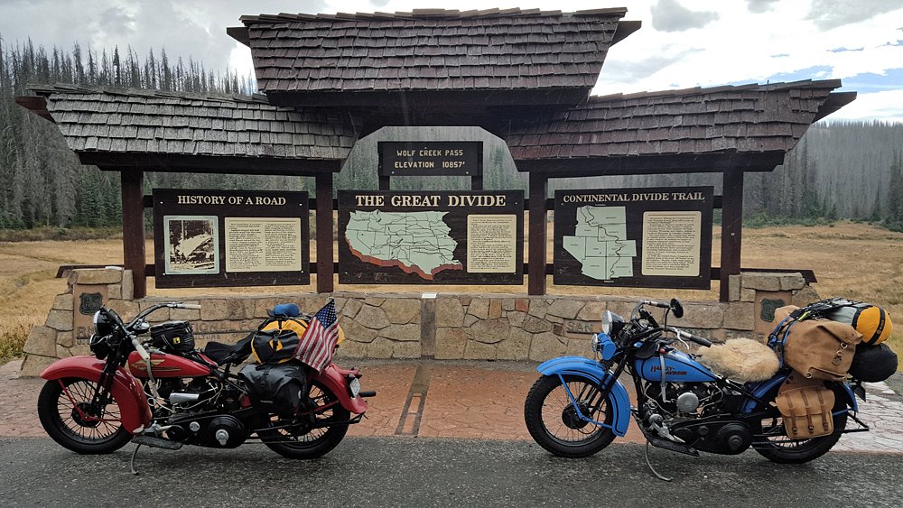
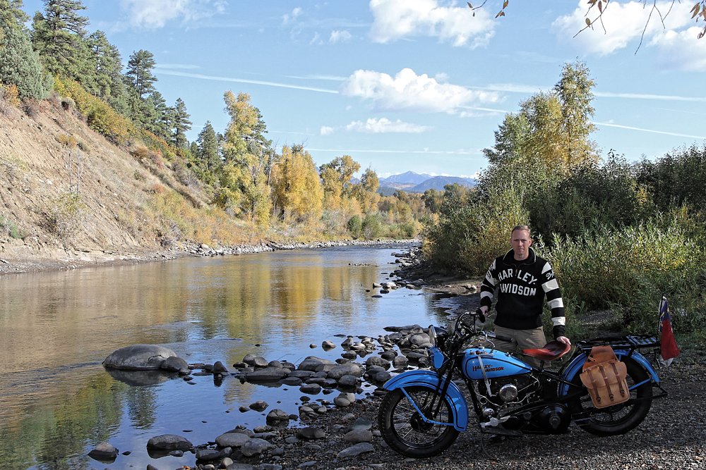
We finally got an authentic taste of the Old West after crossing into Colorado and touring an adobe structure known as “Bent’s Old Fort.” Painstakingly restored by the National Parks Service, Bent’s Old Fort really gave a good look into what life was like on the frontier nearly 200 years ago. From there, we continued along the old Santa Fe Trail, reaching the base of the Rocky Mountains a day later. For our crossing, we chose Wolf Creek Pass, since it was the lowest route (a mere 10,856 feet) and started snaking our way up the mountain.

entering the Rockies
Just starting to climb out of the plains and into the mountains. Maybe I shouldn't have packed so much stuff. Photo by Panhead Jim.

Before the introduction of constant velocity carburetors in the early 1970s, changes in elevation necessitated retuning the carburetor to account for changes in air density. This meant that as we rode up the mountain, we had to adjust the fuel mixture by turning in the high speed needle to limit the amount of fuel going into the motor. Failure to do this would have resulted in an overly rich mixture which would have fouled our sparkplugs and stalled the motors. Luckily, these adjustments can be made while the bike is in motion, although it can be a little dicey riding up a mountain, steering with one hand and leaning over to adjust the carburetor with the other. To increase the difficulty level, it also began to rain as we started our ascent.

Rocky Mountains
Even riding in the rain at nearly 11,000 feet, the bikes soldiered on without complaint. Photo by Panhead Jim.

San Juan River
Riding down to the water's edge for this photo by the San Juan River was easy. Pushing the bike back up the bank without dumping it on the rocks was another matter altogether. Photo by Tim Reida.
The rain relented as we rolled into Pagosa Springs and the reprieve gave us just enough time to get our tents set up along the San Juan River. More rain followed that night, but cleared out by morning, leaving us with sopping-wet gear to pack before our ride to Mesa Verde National Park. We camped two nights in the park and spent an entire day exploring the numerous cliff dwellings scattered across two large mesas. One of the highlights of Mesa Verde is that you actually get to walk through many of the ancient settlements, instead of being corralled behind fences or looking through the window of a tour bus.

Arches National Park
One of the many beautiful sets of arches in Arches National Park. Photo by Panhead Jim.

Hole in the Rock
No photography was allowed inside, but you can probably imagine what a home would look like that was carved inside a rock. Picture a cave with carpet and furniture. Photo by Panhead Jim.
By day 14, we had ventured into Utah and the scenery was nothing short of breathtaking. Cliffs, spires, arches and various other red rock formations could easily be seen as we rode down the often dusty highways accompanied by brutal crosswinds. To add to our list of campy roadside attractions, we stopped at “Hole in the Rock,” which is a 2,000-square-foot home built inside a large rock formation back in the 1940s. The owner constructed the home entirely by himself, with only hand drills, dynamite and an old donkey to help haul rocks. We also spent an afternoon in Arches National Park and took some much needed time off of the bikes while we hiked to various rock formations.

Loneliest road in America
You can see why some might call Route 50 the loneliest road in America, but for a couple of bikers on antique motorcycles, it was perfect. Photo by Panhead Jim.

We joined up with Route 50 after leaving Moab and continued west to Nevada. Life Magazine had famously nicknamed Route 50 through Nevada as the “Loneliest Road in America,” so it sounded like the perfect place to ride two antique bikes that could only make just over 100 miles without needing gas.  Nevada had long ago embraced the moniker and provides an Official Route 50 Survival Guide to all travelers of the road. If you get your Survival Guide stamped in at least five of the eight communities along the way, you can also send off for a certificate signed by the governor and a souvenir lapel pin. Needless to say, we accepted the challenge, along with a little extra insurance in the form of a one-gallon gas jug.

Just like wearing rain gear seems to keep bad weather at bay, the addition of the gas jug ensured that we were able to cover the distances between gas stations without incident. In the end, it turned out that Route 50 was a beautiful stretch of highway with enough civilization to keep both our gas tanks and bellies full all the way across Nevada.

California mountains
Climbing back into the mountains just west of Lake Tahoe. Not as high as the Rockies, but plenty of steep inclines. Photo by Panhead Jim.

We reached eastern California with just four days to go before our return flight back to North Carolina, and as we started to climb back into the mountains, we were more than a little worried about the strain on the bikes. The chance of blowing up a motor while chugging up a steep incline was a very real possibility, so we took care not to “blow it” one day from the coast. Our Californian host and guide, Joe, met us on the other side of the mountains and we breathed a collective sigh of relief as we motored down to sea level.

Golden Gate Bridge
Scenic overlook across from the Golden Gate Bridge. We had to muscle past a few tourists and their selfie sticks, but it was well worth it. Photo by Joe Skaggs.

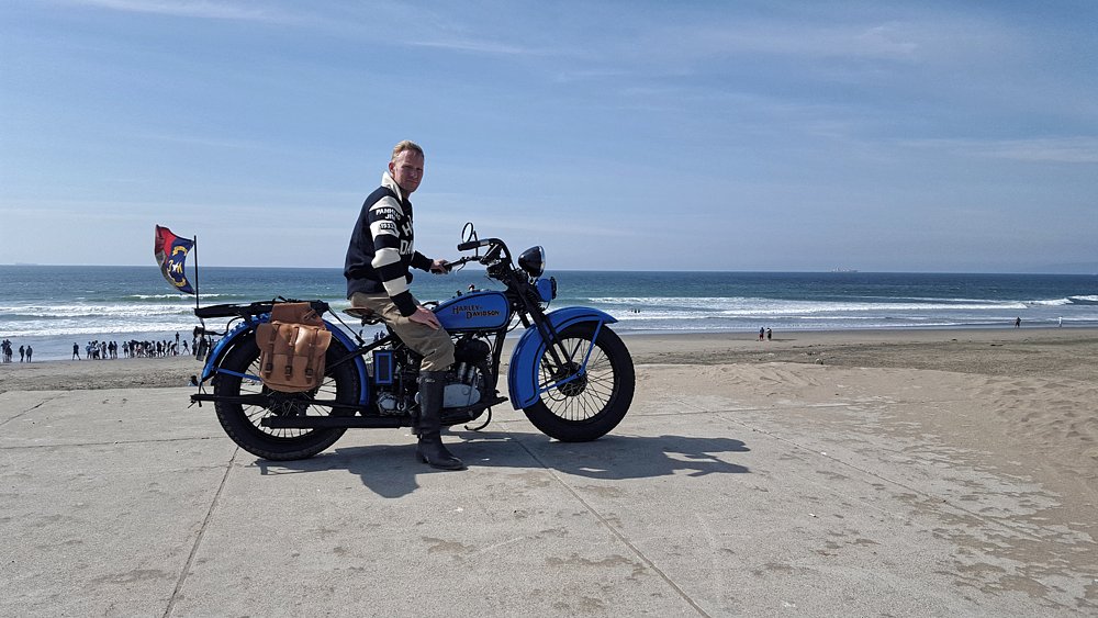
San Francisco was our ultimate goal, and on the nineteenth day of our journey we finally pulled up to the Golden Gate Bridge. Then it was on to the beach to truly complete our coast-to-coast run. All told, we traveled 3,649.5 miles, during which my 1933 VL burned 71 gallons of fuel and dripped 15 quarts of oil along the way. Amazingly, both bikes completed the trip without a single mechanical failure. I attribute that to careful preparation and diligent maintenance along the way.

Pacific Ocean
On the beach in southern San Francisco. A perfect backdrop for the end of our trip. Photo by Joe Skaggs.

Most importantly, I realized my goal of building a bike from scratch and successfully riding it across the country. I also proved that you don’t need a new BMW K 1600 GTL to ride from coast to coast. You just need time, determination and a bit of luck.

trip map
Maybe not the most direct route, but in 3,649.5 miles we got to see more of America than you ever would from the Interstate. Photo by Panhead Jim.